
Aug
30
Well Sunday just past saw a family roast lunch here to catch up with family and a chance to ‘farewell the olds’ which was great and then a headlong rush to Friday to tie up all the loose ends so we could head off to stay the night with Sharen and Ken tonight in Canterbury before we all head for the airport in the morning.
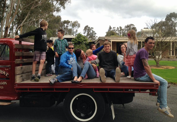
A bonus for some of the grandkids after lunch was a ride around the yard on the back of the Bedford since Norm had fitted an electronic fuel pump much to the delight of the kids large and small.
Cannot believe it but we have finally started the great trek to the USA and Canada and greatly relieved we have. We seem to have been thoroughly immersed with our own Business plus Industry matters over the last few weeks and are relieved we can now call ‘halt’ to all that, take a big breath and just relax. P-H-E-W!!
We are grateful our children and other employees will be holding the fort on the business front in our absence and the fact that our business operates from our home and things are happening all the time with people moving to and fro all hours of the day and night is good security and an added bonus is having our friend Kurt house sitting in our absence.
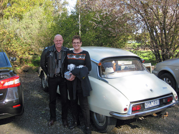
Kurt chauffeured us down to Melbourne in his Citroen so here we are about to leave home.
A bonus for some of the grandkids after lunch was a ride around the yard on the back of the Bedford since Norm had fitted an electronic fuel pump much to the delight of the kids large and small.
Cannot believe it but we have finally started the great trek to the USA and Canada and greatly relieved we have. We seem to have been thoroughly immersed with our own Business plus Industry matters over the last few weeks and are relieved we can now call ‘halt’ to all that, take a big breath and just relax. P-H-E-W!!
We are grateful our children and other employees will be holding the fort on the business front in our absence and the fact that our business operates from our home and things are happening all the time with people moving to and fro all hours of the day and night is good security and an added bonus is having our friend Kurt house sitting in our absence.
Kurt chauffeured us down to Melbourne in his Citroen so here we are about to leave home.
View Comments
Aug
11
Well the countdown is on and I’ve finally figured out how come we always seem to be involved in such huge projects before we head off for a break ….. we’re ALWAYS involved in HUGE projects and this year has been no different with a major undertaking with the National Heavy Vehicle Regulator (NHVR) and another one with Transport SA and Vic Roads this week ….. we really are a couple of nutcases! BUT at the end of all this craziness we are hoping for some positive outcomes for our people and will be riding our motorbikes around Canada and the USA. Yay!!!! Cannot wait to experience the roads, people and scenery of these two great nations and discover again what is the same and what is different in their Transport and Logistics Supply Chain …. Oh and also have a bit of a break at the same time to charge the batteries for another year.
Hope you can come along for the ride!
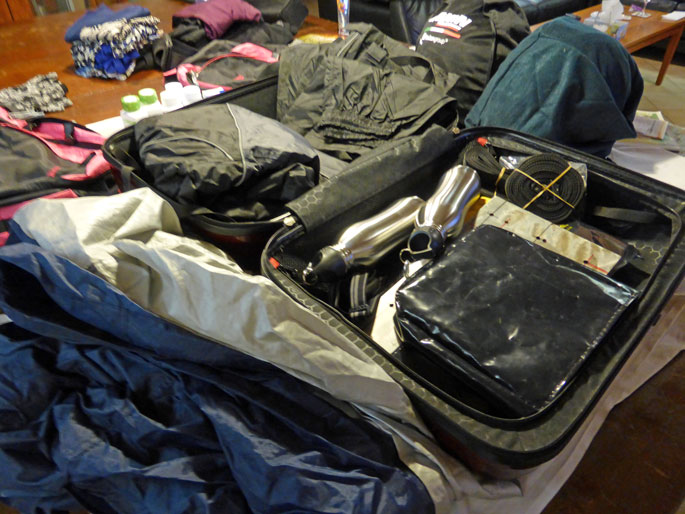
The sifting and sorting begins with what we must fit in cases and what is optional. The first trip of a series is always a challenge with a lot of bike gear so we are confident we have what we need to start the trip The list includes helmets, boots, gloves, neck warmers, kevlar jeans. waterproof suits, bike covers and the list goes on……and that’s not even looking at regular clothes. We ultimately leave the worn out bike stuff behind so never as much to bring back (thankfully). Now I start making lists and laying clothes out and gradually culling things to a manageable size (I hope).
Hope you can come along for the ride!
The sifting and sorting begins with what we must fit in cases and what is optional. The first trip of a series is always a challenge with a lot of bike gear so we are confident we have what we need to start the trip The list includes helmets, boots, gloves, neck warmers, kevlar jeans. waterproof suits, bike covers and the list goes on……and that’s not even looking at regular clothes. We ultimately leave the worn out bike stuff behind so never as much to bring back (thankfully). Now I start making lists and laying clothes out and gradually culling things to a manageable size (I hope).
View Comments
Jul
23
31-Aug-13 FLIGHT DEPARTS MELBOURNE FOR LA & CHICAGO
31-Aug-13 CHICAGO, ILLINOIS
to 03-Sep-13 3 NIGHTS
03-Sep-13 SOUTH HAVEN, MICHIGAN
to 04-Sep-13 1 NIGHT
04-Sep-13 DETROIT, MICHIGAN
to 05-Sep-13 1 NIGHT
05-Sep-13 SAUBLE BEACH, ONTARIO
to 06-Sep-13 1 NIGHT
06-Sep-13 COLLINGWOOD, ONTARIO
to 07-Sep-13 1 NIGHT
07-Sep-13 PRINCE EDWARD COUNTY, ONTARIO
to 08-Sep-13 1 NIGHT
08-Sep-13 OTTAWA, ONTARIO
to 10-Sep-13 2 NIGHTS
10-Sep-13 MONTREAL, QUEBEC
to 12-Sep-13 2 NIGHTS
12-Sep-13 QUEBEC CITY, QUEBEC
to 14-Sep-13 2 NIGHTS
14-Sep-13 GRAND FALLS, NEW BRUNSWICK
to 15-Sep-13 1 NIGHT
15-Sep-13 CHARLOTTETOWN, PRINCE EDWARD ISLAND
to 17-Sep-13 2 NIGHTS
17-Sep-13 BADDECK, NOVA SCOTIA
to 18-Sep-13 1 NIGHT
18-Sep-13 SYDNEY, NOVA SCOTIA
to 19-Sep-13 1 NIGHT,
19-Sep-13 HALIFAX, NOVA SCOTIA
to 20-Sep-13 1 NIGHT
20-Sep-13 ANNAPOLIS ROYAL, NOVA SCOTIA
to 21-Sep-13 1 NIGHT
21-Sep-13 FERRY FROM DIGBY TO SAINT JOHN
21-Sep-13 SAINT ANDREWS, NEW BRUNSWICK
to 22-Sep-13 1 NIGHT
22-Sep-13 CAMDEN, MAINE
to 23-Sep-13 1 NIGHT
23-Sep-13 BOSTON, MASSACHUSETTS
to 25-Sep-13 2 NIGHTS
25-Sep-13 SANDWICH, MASSACHUSETTS
to 27-Sep-13 2 NIGHTS,
27-Sep-13 FERRY FROM WOODS HOLE TO OAK BLUFFS
27-Sep-13 OAK BLUFFS, MATHA'S VINEYARD
to 29-Sep-13 2 NIGHTS
29-Sep-13 FERRY FROM OAK BLUFFS TO WOODS HOLE
29-Sep-13 NEWPORT, RHODE ISLAND
to 01-Oct-13 2 NIGHTS
01-Oct-13 CONCORD, MASSACHUSETTS
to 02-Oct-13 1 NIGHT
02-Oct-13 NORTH CONWAY, NEW HAMPSHIRE
to 03-Oct-13 1 NIGHT
03-Oct-13 QUECHEE, VERMONT
to 04-Oct-13 1 NIGHT
04-Oct-13 STOCKBRIDGE, MASSACHUSETTS
to 05-Oct-13 1 NIGHT
05-Oct-13 STAMFORD, CONNECTICUT
to 06-Oct-13 1 NIGHT
06-Oct-13 PHILADELPHIA, PENNSYLVANIA
to 08-Oct-13 2 NIGHTS
08-Oct-13 LANCASTER, PENNSYLVANIA
to 09-Oct-13 1 NIGHT
09-Oct-13 LIGONIER, PENNSYLVANIA
to 10-Oct-13 1 NIGHT,
10-Oct-13 GETTYSBURG, PENNSYLVANIA
to 12-Oct-13 2 NIGHTS
12-Oct-13 FRONT ROYAL, VIRGINIA
to 13-Oct-13 1 NIGHT
13-Oct-13 CHARLOTTESVILLE, VIRGINIA
to 14-Oct-13 1 NIGHT
14-Oct-13 NORFOLK, VIRGINIA
to 15-Oct-13 1 NIGHT
15-Oct-13 REHOBOTH BEACH, DELAWARE
to 16-Oct-13 1 NIGHT
16-Oct-13 FERRY LEWES TO CAPE MAY
16-Oct-13 NEW YORK CITY, NEW YORK
to 18-Oct-13 2 NIGHTS
18-Oct-13 WILLIAMSPORT, PENNSYLVANIA
to 19-Oct-13 1 NIGHT
19-Oct-13 COUDERSPORT, PENNSYLVANIA
to 20-Oct-13 1 NIGHT
20-Oct-13 WARREN, PENNSYLVANIAA
to 21-Oct-13 1 NIGHT
21-Oct-13 CLEVELAND, OHIO
to 22-Oct-13 1 NIGHT
22-Oct-13 FORT WAYNE, INDIANA
to 23-Oct-13 1 NIGHT
23-Oct-13 SAINT CHARLES, ILLINOIS
to 24-Oct-13 1 NIGHT
24-Oct-13 FLIGHT DEPARTS CHICAGO FOR LA & MELBOURNE
26-Oct-13 Arrive - Melbourne / Home
View Comments
Jul
18
Well the countdown is on to having the itinerary for our US / Canada trip finalised so we will load it on as soon as it all comes together so we know it really is happening and in the meantime we have spread out our suitcases on the billiard table so we can progressively pack and also help us hang on by our very fingernails to sanity (or something resembling that) before we fly out.
PS. Hope you like the new Blog Banner in keeping with our upcoming trip!
PS. Hope you like the new Blog Banner in keeping with our upcoming trip!
View Comments
Jun
30
Outward leg- via Rosedale, Willung (locality), Hiamdale (locality), Gormandale, Willung South (locality), Carrajung South (locality), Woodside, Greenmount (locality), Yarram.
We continued to experiment with cold weather bike gear which we can add to or subtract from so that we are assured of reasonable comfort on the USA / Canada trip later this year since it will be Autumn (Fall) over there and getting late by the time we get the bikes back to Chicago and in spite of it being a cold day we were toasty warm so I’d say we have our bike travel wardrobe finalised. I’ll let the pictures tell the story of the ride.
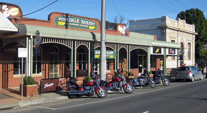
The coffee stop at the bakery at Rosedale. Note the wood carving of Ned Kelly out front, there are lots of other examples of this work inside.
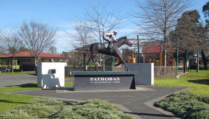
A statue of Patrobas the 1915 Melbourne Cup winner which was a local horse. This stands in what used to be the Primary School playground but is now a community park and gathering area.
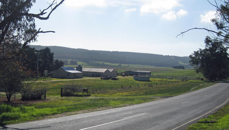
A glimpse of farm life looking down the valley which runs along Merriman Creek between Hiamdale and Gormandale.
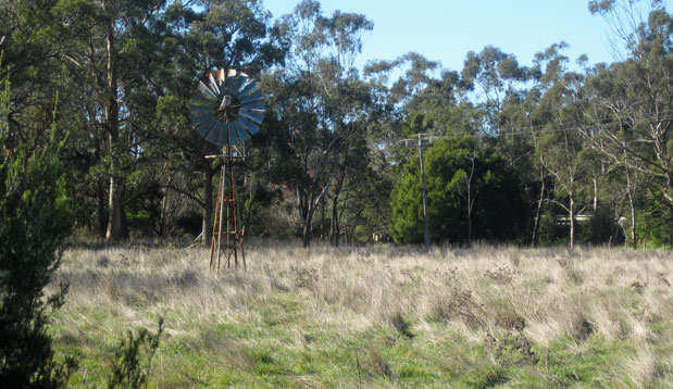
An Aussie windmill near the intersection of the Carrajung Woodside Road and the South Gippsland Highway at Woodside.
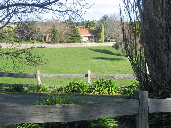
An attractive setting . A property at the junction of the South Gippsland Highway and the Hyland Highway.
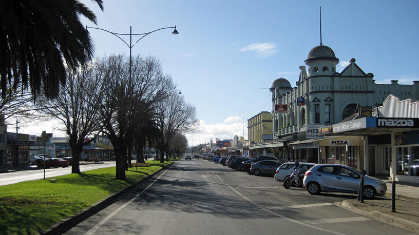
A view along the main street in Yarram. Our lunch spot is a little cafe just out of the frame to the right. They serve a yummy baked potato second only to the Gate Inn at Marshside (UK) and let me tell you that is high praise indeed.
Return leg – via Devon North, Calrossie (locality) Balook, Koornalla (locality), Traralgon South, Loy Yang (locality), Traralgon
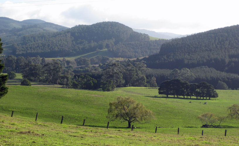
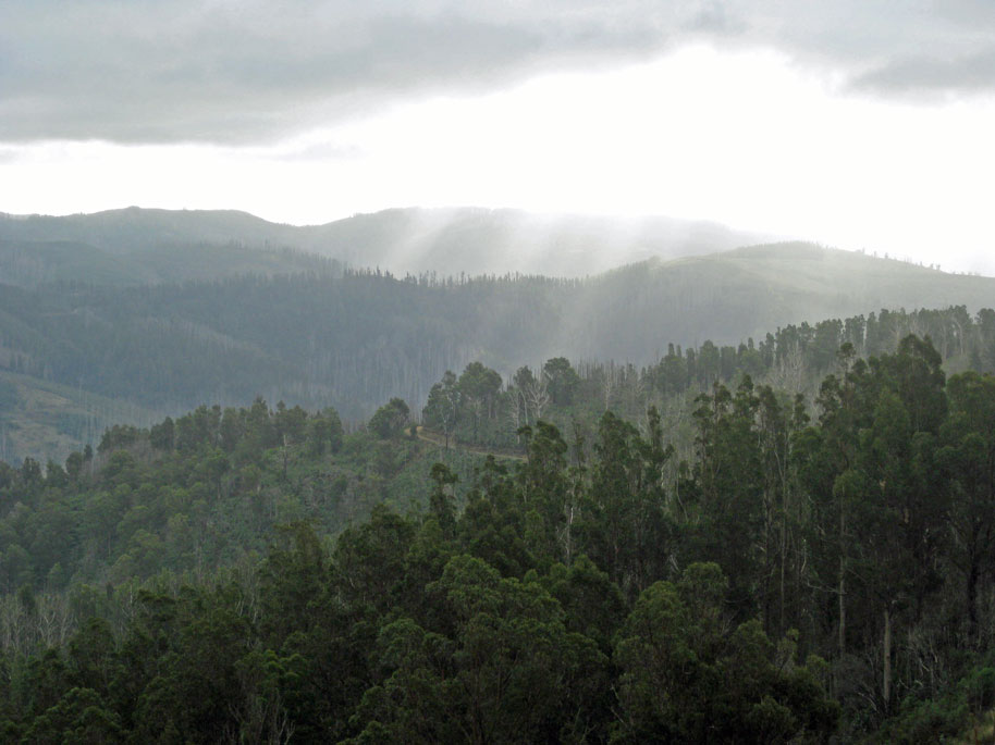
A view from the roadside to the plantation covered hills as we head for the leafy glades of Tarra Valley.
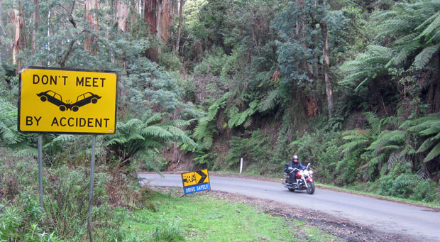
An example of some of the tall timbers and ferns in Tarra Valley. No picture can do it justice. Like the sign encouraging responsible travel!
Late afternoon as we descend back to the valley floor from Balook.
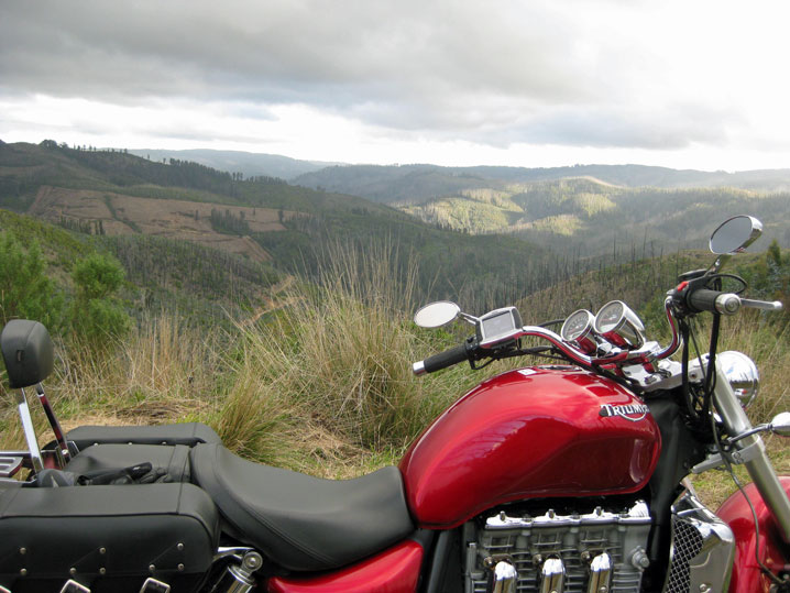
A glimpse of continuing work on restoration of the timber plantations post bushfires….oh and yes a rocket as well….wonder who took that shot!
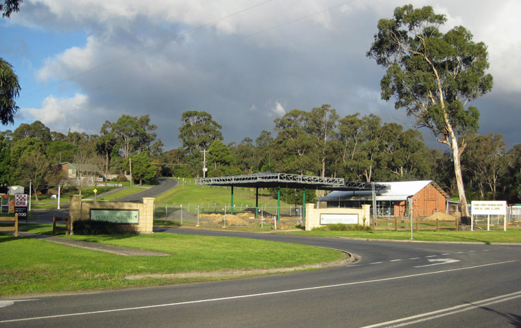
The entry to the little village of Traralgon South.
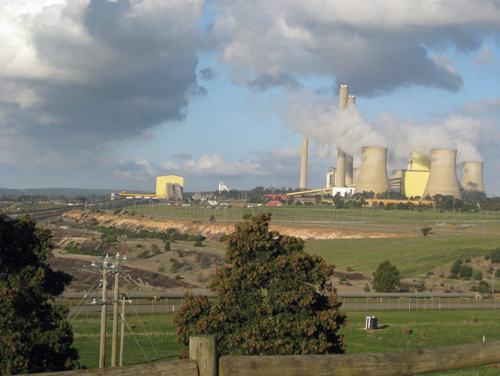
Looking across to Loy Yang Power Station from the Miners View lookout.
Tips to remember for the roads we covered:
The roads we travelled on today ranged from lots of corners through the hills and the closer we got to the coast the flatter the land was and the straighter the roads. The surface was good and the scenery changed back and forth from native bush with some small pockets of temperate rainforest to plantation timber and beef and dairy cattle country.
The exception to this is the Tarra Valley Road from Devon North to the Grand Ridge Road just before Balook which runs through the Tarra Valley park and the views are spectacular but the road is very narrow and winding with a number of one lane bridges and road width which barely supports cars beside one another. This time of year also (winter) the majority of it though sealed was wet and slippery with large quantities of sodden bark and leaf litter across the surface so you need to ride accordingly.
From Balook back down to Traralgon South the road surface has been badly affected from the Gippsland fires a few years ago as well as increased logging traffic to salvage as much of the burnt timber as possible and the surface has its challenges but is generally well signed.
Services available:
Large towns:
Traralgon and Yarram
Fuel: Multiple choices including Premium Unleaded, most BH but also some 24hr
Accommodation: Hotel, Motel, B&B and Caravan Park and Camping options and maybe some Serviced Apartments
Food: Multiple choices from small cafes to bistro’s bars and fine restaurants
Food and General Store / Supermarket: Multiple choices, small to large
Small towns:
Rosedale
Fuel: Limited and often BH only if any at all
Accommodation: Limited Hotel, B&B and Caravan Park and Camping options
Food and General Store / Supermarket: Limited and not necessarily open on weekends
Small isolated Localities:
All the rest
Fuel: Not likely
Accommodation: If you’re lucky and have done your research
Food and General Store / Supermarket: Unlikely so bring your own
We continued to experiment with cold weather bike gear which we can add to or subtract from so that we are assured of reasonable comfort on the USA / Canada trip later this year since it will be Autumn (Fall) over there and getting late by the time we get the bikes back to Chicago and in spite of it being a cold day we were toasty warm so I’d say we have our bike travel wardrobe finalised. I’ll let the pictures tell the story of the ride.
The coffee stop at the bakery at Rosedale. Note the wood carving of Ned Kelly out front, there are lots of other examples of this work inside.
A statue of Patrobas the 1915 Melbourne Cup winner which was a local horse. This stands in what used to be the Primary School playground but is now a community park and gathering area.
A glimpse of farm life looking down the valley which runs along Merriman Creek between Hiamdale and Gormandale.
An Aussie windmill near the intersection of the Carrajung Woodside Road and the South Gippsland Highway at Woodside.
An attractive setting . A property at the junction of the South Gippsland Highway and the Hyland Highway.
A view along the main street in Yarram. Our lunch spot is a little cafe just out of the frame to the right. They serve a yummy baked potato second only to the Gate Inn at Marshside (UK) and let me tell you that is high praise indeed.
Return leg – via Devon North, Calrossie (locality) Balook, Koornalla (locality), Traralgon South, Loy Yang (locality), Traralgon
A view from the roadside to the plantation covered hills as we head for the leafy glades of Tarra Valley.
An example of some of the tall timbers and ferns in Tarra Valley. No picture can do it justice. Like the sign encouraging responsible travel!
Late afternoon as we descend back to the valley floor from Balook.
A glimpse of continuing work on restoration of the timber plantations post bushfires….oh and yes a rocket as well….wonder who took that shot!
The entry to the little village of Traralgon South.
Looking across to Loy Yang Power Station from the Miners View lookout.
Tips to remember for the roads we covered:
The roads we travelled on today ranged from lots of corners through the hills and the closer we got to the coast the flatter the land was and the straighter the roads. The surface was good and the scenery changed back and forth from native bush with some small pockets of temperate rainforest to plantation timber and beef and dairy cattle country.
The exception to this is the Tarra Valley Road from Devon North to the Grand Ridge Road just before Balook which runs through the Tarra Valley park and the views are spectacular but the road is very narrow and winding with a number of one lane bridges and road width which barely supports cars beside one another. This time of year also (winter) the majority of it though sealed was wet and slippery with large quantities of sodden bark and leaf litter across the surface so you need to ride accordingly.
From Balook back down to Traralgon South the road surface has been badly affected from the Gippsland fires a few years ago as well as increased logging traffic to salvage as much of the burnt timber as possible and the surface has its challenges but is generally well signed.
Services available:
Large towns:
Traralgon and Yarram
Fuel: Multiple choices including Premium Unleaded, most BH but also some 24hr
Accommodation: Hotel, Motel, B&B and Caravan Park and Camping options and maybe some Serviced Apartments
Food: Multiple choices from small cafes to bistro’s bars and fine restaurants
Food and General Store / Supermarket: Multiple choices, small to large
Small towns:
Rosedale
Fuel: Limited and often BH only if any at all
Accommodation: Limited Hotel, B&B and Caravan Park and Camping options
Food and General Store / Supermarket: Limited and not necessarily open on weekends
Small isolated Localities:
All the rest
Fuel: Not likely
Accommodation: If you’re lucky and have done your research
Food and General Store / Supermarket: Unlikely so bring your own
View Comments
Jun
19
Well things are progressing well for our USA / Canada trip plans.
Thanks to Robert (Du-Page Honda and Yamaha, Chicago) and nephew Kevin (Louisiana) we now have bikes (sourcing some additional accessories) and bike insurance and registration. I hope to finalise toll tags tomorrow (which will cover interstate / toll roads apart from a few bridges built by local authorities where we will still need to dig in our pockets for some real money). As well as that the GPS map cards I ordered have also arrived and we have measured what we need to on a 950 Yamaha bike at the Traralgon Yamaha shop as far as fitting suitcases and GPS brackets on the USA bikes so things are on track for the next adventure.
I will load the itinerary when it is finalised (only a handful of bookings to go now.)
We have also bought a GoPro camera to capture some video footage …. all we need is some time and ‘brain space’ to figure out how to use / drive it before then …. and have bought another still camera as well so need to find / make some time between now and the departure so we aren’t learning all this on the fly.
View Comments
May
20
Outward leg, straight down the highway to Pakenham then struck out through Cockatoo, Yellingbo, Woori Yallock, Healesville, St Fillans, Buxton, Taggerty, Acheron, Alexandra, Yarck, Merton, Woodfield, Bonnie Doon, Mansfield, Tolmie, Whitfield, Moyhu, Docker, Oxley, Milawa, Myrtleford, Eurobin, Porepunkah to Bright.
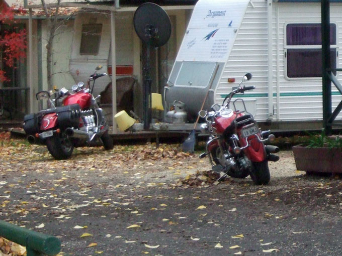
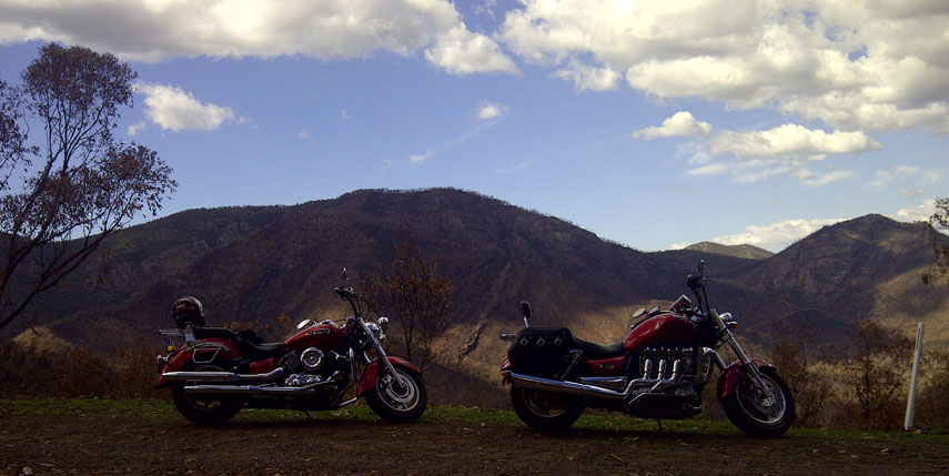
A couple of good looking bikes which were a lot cleaner here than when they got home
We had fine but cold weather as we headed out then struck rain which made for some slippery corners through some hilly sections before lunch at Healesville and for a bit afterwards but it fined up and the ride through the King Valley was just beautiful with lovely sweeping corners and splashes of autumn crimson and gold to accompany us on the trip and the closer we got to Bright the better the colours became. It was like the countryside was dressed up in its finest for the occasion. Beautiful!
A splash of olour - our caravan park, not as spectacular as in Bright but we were a fir bit out of town
One regret, group ride so no opportunity to stop for photos ..…. Norm forgot his camera and my phone was buried where gloved fingers could not retrieve it. I have made use of some pics taken by other riders. Thanks guys! We will definitely do an autumn ride again by ourselves and stop for many pics to capture the colour of the autumn changes as well as the clarity of the views of hills.
Return leg, Germantown, Freeburgh, Harrietville, Hotham Heights, Dinner Plain, Omeo, Swifts Creek, Doctors Flat, Ensay, Tambo Crossing, Bruthen, Sarsfield, Lucknow, Bairnsdale, Stratford, Maffra, Tinamba, Heyfield, Cowwarr, Toongabbie, Glengarry and home.
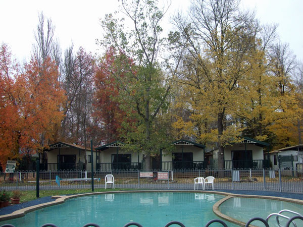
Again in the caravan park and needless to say the pool didn't attract any swimmers
After consultation with the local Bright Police who assured us the road over Mt Hotham was clear we headed off for a shorter and in theory more comfortable ride. Nice theory…and some of it was true. The ride was spectacular with autumn colours on steroids between Bright and Harrietville and then increasing fog as we climbed the mountain which somehow softened the surrounding devastation of summer fires on the bush.
We encountered (and survived) some seriously muddy slushy roadwork’s (thankfully there were traffic lights so we could use whichever part of the road we needed to) and ultimately snow, slush and ice on the road we had to ride through as we approached Mt Hotham and saw heaps more snow (thankfully on the side of the road) which looked impressive though somewhat daunting.
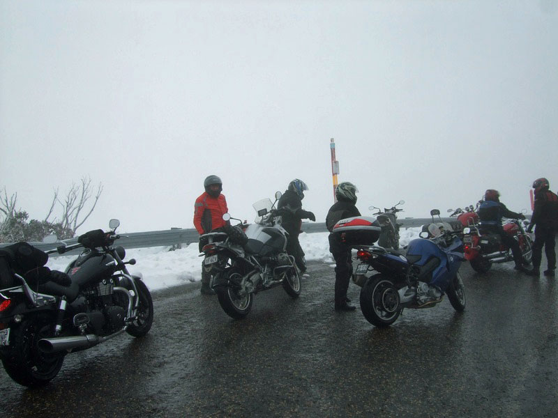
Pulling over to check how everyone was travelling after riding through the ice and snow. You will notice there is still much fog about as well as ice on the road.
From here we headed for Dinner Plain and arrived in the sunshine and no snow and had a welcome coffee before heading for lunch at Bruthen then home. One of our members who had a temperature gauge on his bike told us the temperature had dropped to minus 1 degree centigrade over the top of the mountain and I’m happy to say we felt comfortable in our gear.
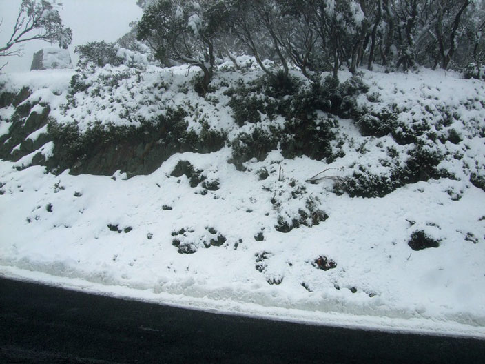
The snow across the road from where we parked up near the top of Mt Hotham.....and it increased in depth and coverage from here on up and down a considerable distance on the other side. Awesome!
The day remained dry from here until about 10 minutes from Traralgon. I swear Murphy never rests!
Today – every bit of me that could feel tender and complain that it has worked hard on the weekend is doing so!
For road conditions on this ride you can scroll back through other entries over the same territory.
A couple of good looking bikes which were a lot cleaner here than when they got home
We had fine but cold weather as we headed out then struck rain which made for some slippery corners through some hilly sections before lunch at Healesville and for a bit afterwards but it fined up and the ride through the King Valley was just beautiful with lovely sweeping corners and splashes of autumn crimson and gold to accompany us on the trip and the closer we got to Bright the better the colours became. It was like the countryside was dressed up in its finest for the occasion. Beautiful!
A splash of olour - our caravan park, not as spectacular as in Bright but we were a fir bit out of town
One regret, group ride so no opportunity to stop for photos ..…. Norm forgot his camera and my phone was buried where gloved fingers could not retrieve it. I have made use of some pics taken by other riders. Thanks guys! We will definitely do an autumn ride again by ourselves and stop for many pics to capture the colour of the autumn changes as well as the clarity of the views of hills.
Return leg, Germantown, Freeburgh, Harrietville, Hotham Heights, Dinner Plain, Omeo, Swifts Creek, Doctors Flat, Ensay, Tambo Crossing, Bruthen, Sarsfield, Lucknow, Bairnsdale, Stratford, Maffra, Tinamba, Heyfield, Cowwarr, Toongabbie, Glengarry and home.
Again in the caravan park and needless to say the pool didn't attract any swimmers
After consultation with the local Bright Police who assured us the road over Mt Hotham was clear we headed off for a shorter and in theory more comfortable ride. Nice theory…and some of it was true. The ride was spectacular with autumn colours on steroids between Bright and Harrietville and then increasing fog as we climbed the mountain which somehow softened the surrounding devastation of summer fires on the bush.
We encountered (and survived) some seriously muddy slushy roadwork’s (thankfully there were traffic lights so we could use whichever part of the road we needed to) and ultimately snow, slush and ice on the road we had to ride through as we approached Mt Hotham and saw heaps more snow (thankfully on the side of the road) which looked impressive though somewhat daunting.
Pulling over to check how everyone was travelling after riding through the ice and snow. You will notice there is still much fog about as well as ice on the road.
From here we headed for Dinner Plain and arrived in the sunshine and no snow and had a welcome coffee before heading for lunch at Bruthen then home. One of our members who had a temperature gauge on his bike told us the temperature had dropped to minus 1 degree centigrade over the top of the mountain and I’m happy to say we felt comfortable in our gear.
The snow across the road from where we parked up near the top of Mt Hotham.....and it increased in depth and coverage from here on up and down a considerable distance on the other side. Awesome!
The day remained dry from here until about 10 minutes from Traralgon. I swear Murphy never rests!
Today – every bit of me that could feel tender and complain that it has worked hard on the weekend is doing so!
For road conditions on this ride you can scroll back through other entries over the same territory.
View Comments
Apr
25
First leg via Rosedale, Stratford (for coffee), Stockdale (locality) to the Dargo Road via Beverley’s Road, Cobbannah (locality) Waterford (locality) to Dargo and lunch.
Since it was ANZAC Day today we decided to celebrate the freedom the armed forces have fought for on our behalf and the rest of our Nations citizens in the past and continue to do so and headed for Dargo which is a spectacular ride so to go there is also a sense of celebration so somehow seemed fitting for the day.
The Wool Store near Sale
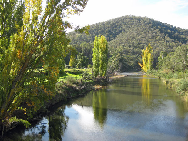
A view up the River Avon amongst the poplars and willows as they start their Autumn show and the remaining bridge uprights from many years ago. Taken from the bridge on the Princes Highway heading into Stratford
Beverley’s Road winding through pine plantations is a delight to ride. Shame the photo doesn’t do it justice
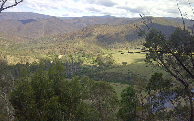
A brief glimpse of a splash of colour beside the Wonnangatta River from the Waterford Bridge
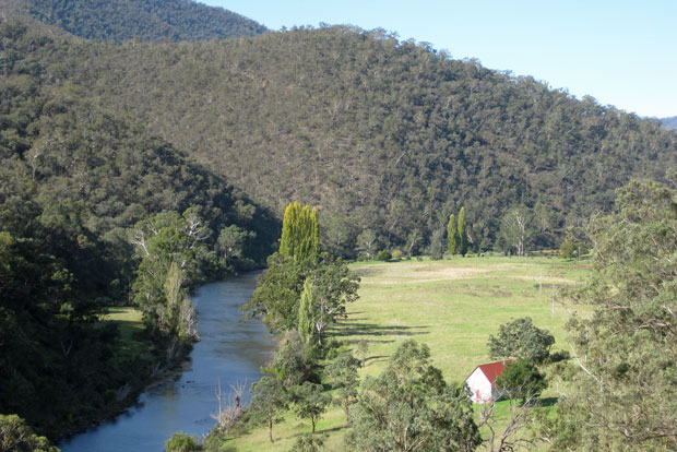
A view of a Wonnangatta River flat
Heading down the hill to Dargo nestled at the foot of the hill to the left
Self-explanatory
Second leg back down the Dargo Road and Beverley’s Road to Briagolong via the Blue Pools then on to Boisdale, Maffra, Tinamba, Cowwarr, Toongabbie, Glengarry and home.
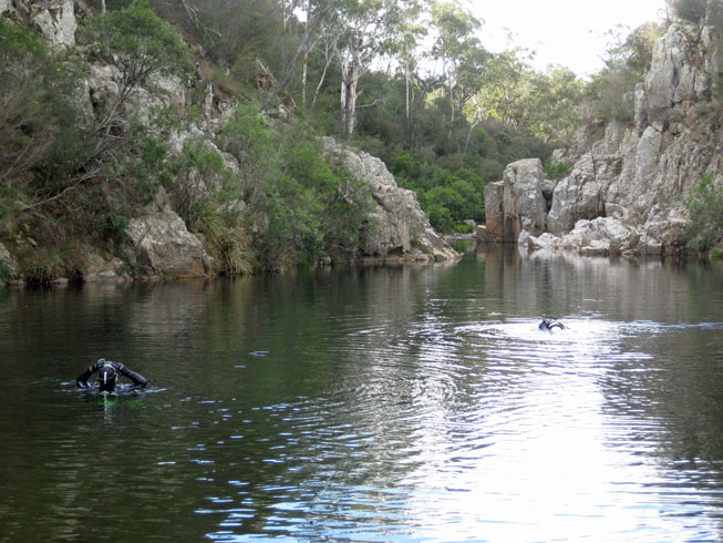
Blue Pools near Briagolong. The two divers had been down to 7meters and the water was still quite clear. Incredibly pretty. Will definitely go back another day earlier in the day so the sun is high in the sky and the pools aren’t in the shade
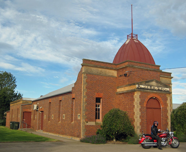
Boisdale Public Hall
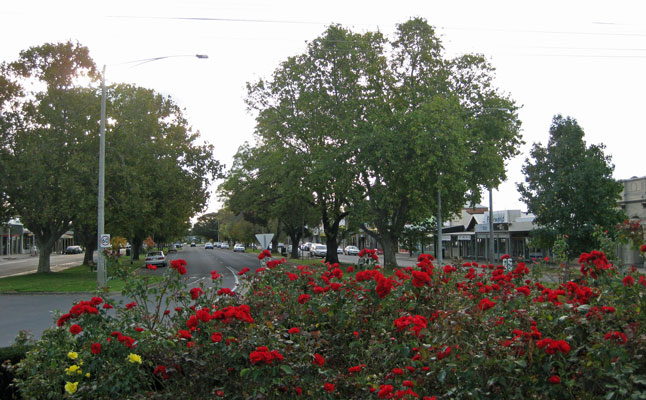
A view down the main street of Maffra, a picturesque little town
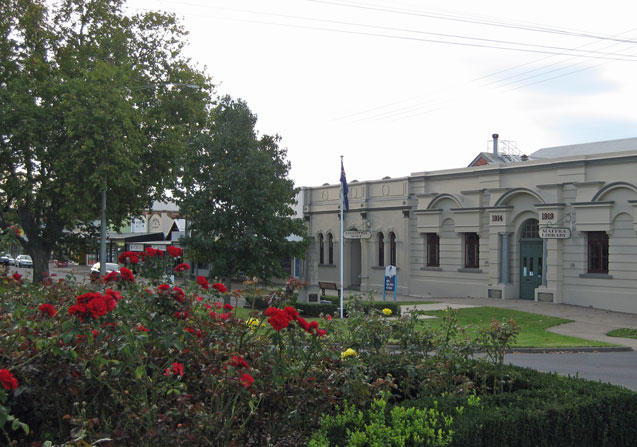
Maffra Memorial Hall and Library
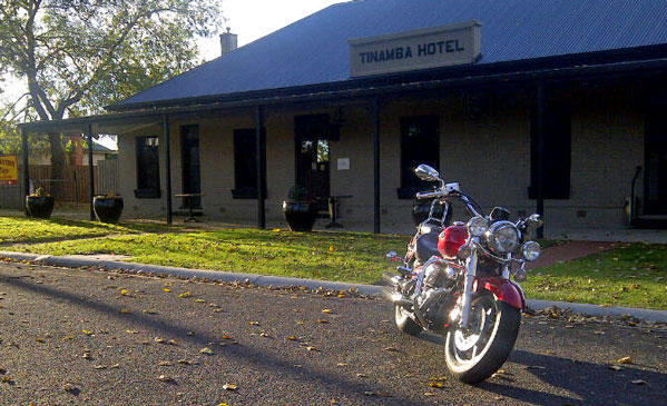
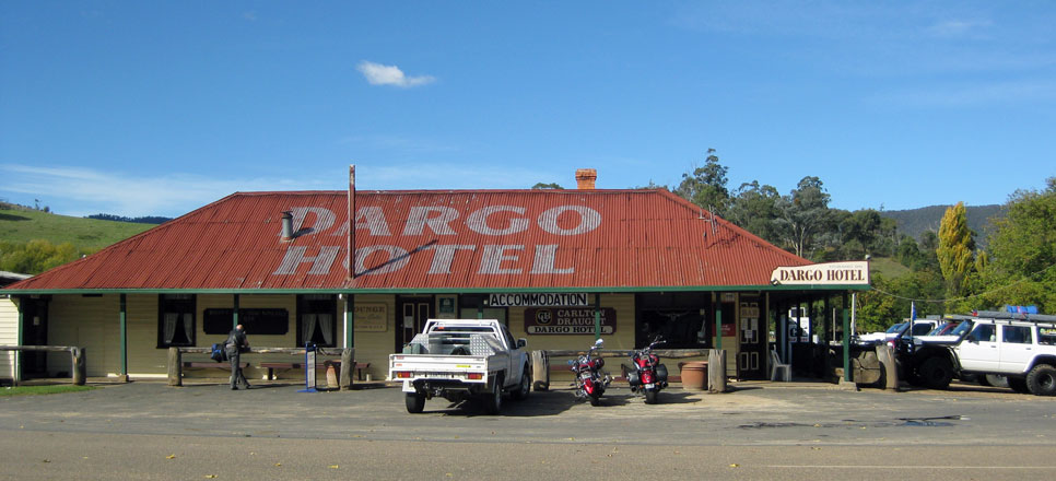
The Tinamba Hotel late in the day and a very nice Yamaha XVS 1100

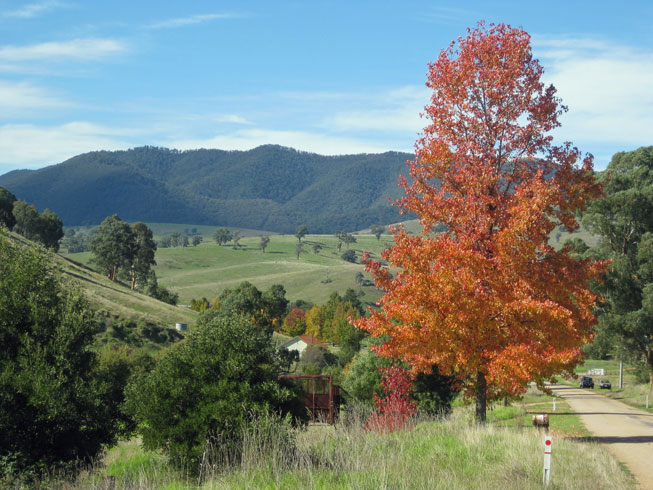
Autumn tones in Tinamba
Tips to remember for the roads we covered:
The road from Stratford to the Dargo Road is beautiful to ride. The land is gently undulating for the majority of it with gentle sweeping corners. There are few advisory signs on this stretch which doesn’t matter for all but a couple of corners so bear that in mind as you approach any corners on a crest. The terrain along the Dargo Road is definitely steeper and a lot of the corners are tighter and more challenging but well signed with advisory signs. It is also worth remembering that heavy rain or road works will leave the potential of small loose gravel washes on corners so be aware of that. Oh and try not to run off the road looking at the spectacular scenery!
Services available:
Large towns:
Fuel: Multiple choices including Premium Unleaded, most BH but also some 24hr
Accommodation: Hotel, Motel, B&B and Caravan Park and Camping options and maybe some Serviced Apartments
Food: Multiple choices from small cafes to bistro’s bars and fine restaurants
General Store / Supermarket: Multiple choices, small to large
Small towns:
Fuel: Limited and often BH only if any at all
Accommodation: Limited Hotel, B&B and Caravan Park and Camping options
Food and General Store / Supermarket: Limited and not necessarily open on weekends
Small isolated Localities:
Fuel: Not likely
Accommodation: If you’re lucky and have done your research
Food and General Store / Supermarket: Unlikely so bring your own
Since it was ANZAC Day today we decided to celebrate the freedom the armed forces have fought for on our behalf and the rest of our Nations citizens in the past and continue to do so and headed for Dargo which is a spectacular ride so to go there is also a sense of celebration so somehow seemed fitting for the day.
The Wool Store near Sale
A view up the River Avon amongst the poplars and willows as they start their Autumn show and the remaining bridge uprights from many years ago. Taken from the bridge on the Princes Highway heading into Stratford
Beverley’s Road winding through pine plantations is a delight to ride. Shame the photo doesn’t do it justice
A brief glimpse of a splash of colour beside the Wonnangatta River from the Waterford Bridge
A view of a Wonnangatta River flat
Heading down the hill to Dargo nestled at the foot of the hill to the left
Self-explanatory
Second leg back down the Dargo Road and Beverley’s Road to Briagolong via the Blue Pools then on to Boisdale, Maffra, Tinamba, Cowwarr, Toongabbie, Glengarry and home.
Blue Pools near Briagolong. The two divers had been down to 7meters and the water was still quite clear. Incredibly pretty. Will definitely go back another day earlier in the day so the sun is high in the sky and the pools aren’t in the shade
Boisdale Public Hall
A view down the main street of Maffra, a picturesque little town
Maffra Memorial Hall and Library
The Tinamba Hotel late in the day and a very nice Yamaha XVS 1100
Autumn tones in Tinamba
Tips to remember for the roads we covered:
The road from Stratford to the Dargo Road is beautiful to ride. The land is gently undulating for the majority of it with gentle sweeping corners. There are few advisory signs on this stretch which doesn’t matter for all but a couple of corners so bear that in mind as you approach any corners on a crest. The terrain along the Dargo Road is definitely steeper and a lot of the corners are tighter and more challenging but well signed with advisory signs. It is also worth remembering that heavy rain or road works will leave the potential of small loose gravel washes on corners so be aware of that. Oh and try not to run off the road looking at the spectacular scenery!
Services available:
Large towns:
Fuel: Multiple choices including Premium Unleaded, most BH but also some 24hr
Accommodation: Hotel, Motel, B&B and Caravan Park and Camping options and maybe some Serviced Apartments
Food: Multiple choices from small cafes to bistro’s bars and fine restaurants
General Store / Supermarket: Multiple choices, small to large
Small towns:
Fuel: Limited and often BH only if any at all
Accommodation: Limited Hotel, B&B and Caravan Park and Camping options
Food and General Store / Supermarket: Limited and not necessarily open on weekends
Small isolated Localities:
Fuel: Not likely
Accommodation: If you’re lucky and have done your research
Food and General Store / Supermarket: Unlikely so bring your own
View Comments
Apr
13
After three separate attempts to navigate our way through the US Financial system we have finally completed payment for the two bikes and are beginning to put our list together for what we want fitted to them before our arrival.
You can check out a couple of photos of the bikes on the blog if you scroll down to the February 22nd entry.
In the meantime we are progressively working our way through accommodation bookings at yummy places like South Haven, Martha’s Vineyard and Newport Rhode Island and getting really excited as we check out the photographs of the properties, the surrounding countryside and attractions in the vicinity. Can’t believe it is finally happening.
I will load the itinerary when it is finalised so you can include your ‘must see /do’ suggestions for us.
View Comments
Mar
24
Local rides: Traralgon to Licola (via Rosedale, Dennison, Heyfield, Glenmaggie) and return (via Seat
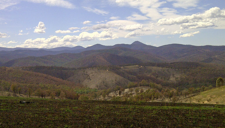
We felt like a ride and the sky to the south and west looked unbelievably black so we decided we wanted a bit more comfort than that and headed east for Licola. We hadn’t been there since the extensive fires the region had experienced a few weeks ago and we were shocked at the extent of the damage.
The first glimpse towards the ranges. A combination of black, rust and the beginnings of green.
The last big fires up here some years ago were followed by unseasonal rain and flooding washing huge amounts of loose soil off the hills and into rivers. Really destructive.
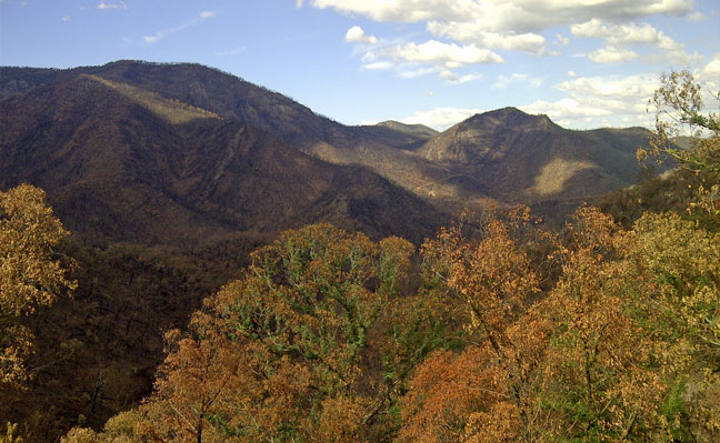
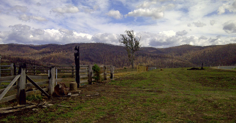
We rode straight through to Licola and took some photos on the way back. Somewhat an overstatement (not very) what wasn’t burnt in the last fires, and a big percentage of the regrowth as well as a lot more than that has been burnt this time. There were thousands of acres burnt and no matter where we looked we could see the rusty colour of scorched foliage draped over hills with bare earth and ash underneath.
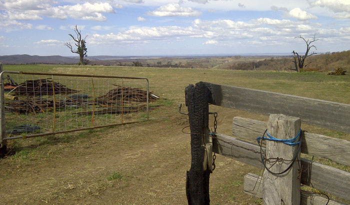
Looking out from the top of the CRB hill
We could also see the beginnings of a green tinge in some areas where there has obviously been rain since but the wind was ferocious on the way up and we could literally see dust and ash lifting off the top of hills in clouds. Way too gritty to have our visors open. Hope the high winds don’t get rid of too much ash though the wind made for a great spectacle of clouds at different levels moving in opposite directions. Impressive!
Rusty view as we head back from Licola
And looking back up the road with some signs of regeneration.
Rugged rocky faces scorched at best.
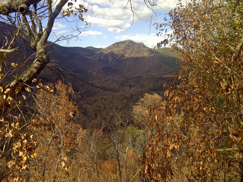
Autumn tone colours compliments of the fires plus some real colour!
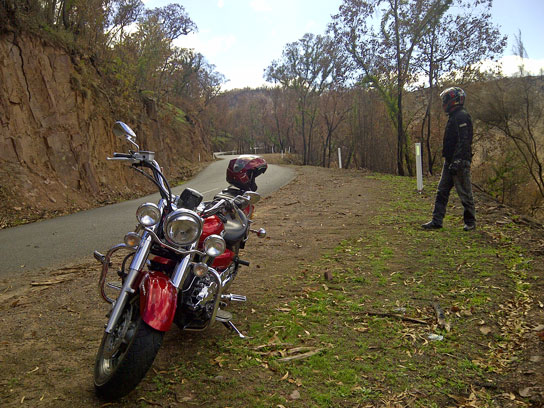
Oh come on Norm, I wasn't taking that long to get some pics!
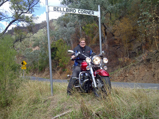
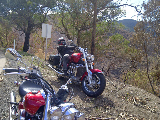
Had to get another shot at the Bellbird corner!
Tips to remember for the roads we covered:
The roads we travelled on were cambered well and good surface overall and well signed with targeted advisory speed signs. Once we started heading for the hills there were lots of tight corners and nice sweeping S bends. Many rock fall areas which of course were worse after the fires so needed to be wary of large rocks as well as gravel washes on some corners. A lot of tree debris in evidence today with the combination of strong wind and fire damage with huge amounts of bark leaves and broken branches in evidence.
Looking towards Lake Glenmaggie, recovery efforts underway.
Devastation beside restoration is the reality. Must be tough to tackle day after day.
After being surrounded by so much country and wooded areas which were fire affected it was almost an assault to my senses to travel through the intense green of irrigated crops in the Cowwarr region on our way home. One extreme to another.
Services available:
See the previous entry for this area, follow the link below:
http://blog.branstrans.com.au/index.php ... 217-105925
The first glimpse towards the ranges. A combination of black, rust and the beginnings of green.
The last big fires up here some years ago were followed by unseasonal rain and flooding washing huge amounts of loose soil off the hills and into rivers. Really destructive.
We rode straight through to Licola and took some photos on the way back. Somewhat an overstatement (not very) what wasn’t burnt in the last fires, and a big percentage of the regrowth as well as a lot more than that has been burnt this time. There were thousands of acres burnt and no matter where we looked we could see the rusty colour of scorched foliage draped over hills with bare earth and ash underneath.
Looking out from the top of the CRB hill
We could also see the beginnings of a green tinge in some areas where there has obviously been rain since but the wind was ferocious on the way up and we could literally see dust and ash lifting off the top of hills in clouds. Way too gritty to have our visors open. Hope the high winds don’t get rid of too much ash though the wind made for a great spectacle of clouds at different levels moving in opposite directions. Impressive!
Rusty view as we head back from Licola
And looking back up the road with some signs of regeneration.
Rugged rocky faces scorched at best.
Autumn tone colours compliments of the fires plus some real colour!
Oh come on Norm, I wasn't taking that long to get some pics!
Had to get another shot at the Bellbird corner!
Tips to remember for the roads we covered:
The roads we travelled on were cambered well and good surface overall and well signed with targeted advisory speed signs. Once we started heading for the hills there were lots of tight corners and nice sweeping S bends. Many rock fall areas which of course were worse after the fires so needed to be wary of large rocks as well as gravel washes on some corners. A lot of tree debris in evidence today with the combination of strong wind and fire damage with huge amounts of bark leaves and broken branches in evidence.
Looking towards Lake Glenmaggie, recovery efforts underway.
Devastation beside restoration is the reality. Must be tough to tackle day after day.
After being surrounded by so much country and wooded areas which were fire affected it was almost an assault to my senses to travel through the intense green of irrigated crops in the Cowwarr region on our way home. One extreme to another.
Services available:
See the previous entry for this area, follow the link below:
http://blog.branstrans.com.au/index.php ... 217-105925
View Comments
Get this feed 